MAPC
Smart Growth & Regional Collaboration
Insight on the past, present, and future of Metro Boston.
The Research Group creates new data resources and conducts original analysis to provide insight on the past, present, and future of Metro Boston. We cultivate new datasets by mining administrative records, compiling on-line sources, or crowd-sourcing information from community partners. Our demographic and land use projections serve as the foundation for a wide variety of planning and policy activities; and our original research on demographic, economic, and housing trends helps planners and policymakers make informed decisions about the future of the region. We also help MAPC to monitor progress toward the goals of the MetroFuture through our Regional Indicators program.
Recent Publications:
- Hidden and in Plain Sight: The Impacts of E-Commerce in Massachusetts
- Housing Submarkets
- The Impacts of Land Use and Pricing in Reducing Vehicle Miles Traveled and Transport Emissions in Massachusetts
General Questions?
For more information on Research at MAPC, contact Jessie Partridge Guerrero, Research Manager at [email protected].
Rethinking the Retail Strip
January 2022
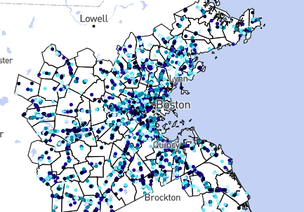
MAPC analyzed more than 3,000 strip malls and similar shopping centers across Greater Boston, then set out to understand the potential impacts of redeveloping them. Can they help close gaps in access to affordable housing, transportation, and more?
The report found that if just 10% were redeveloped into mixed-use projects, 124,000 homes could be created, increasing building values to the tune of $479 million in extra tax revenue for host communities.
Hidden and in Plain Sight: Impacts of E-Commerce in Massachusetts
February 2021
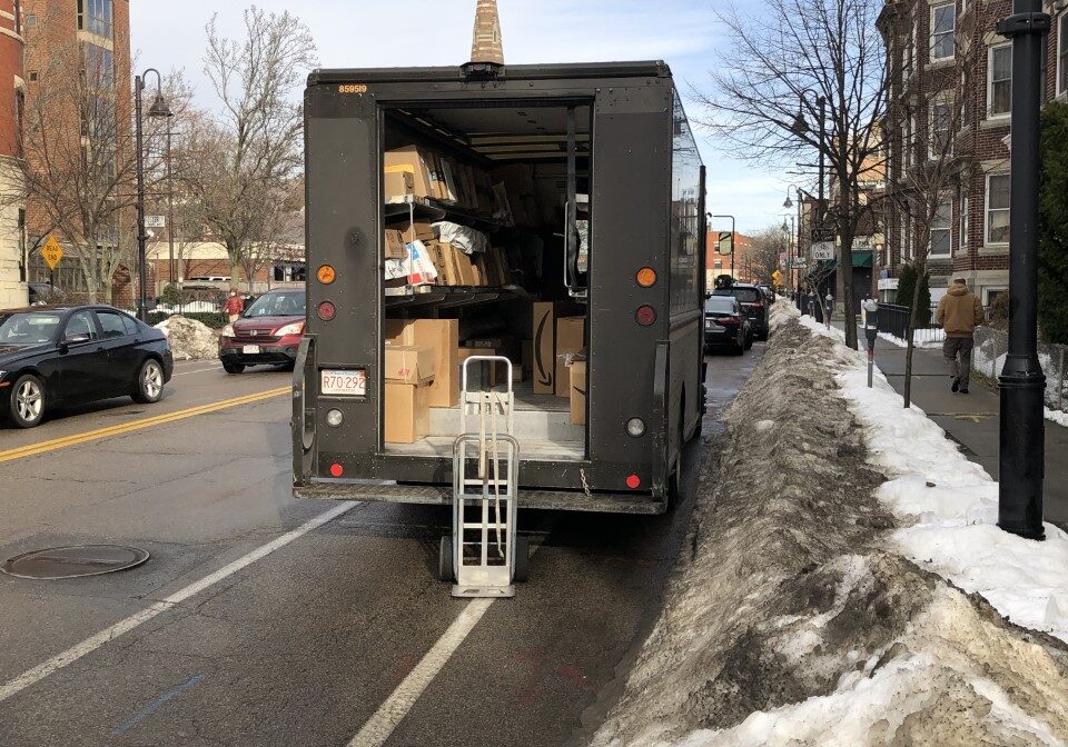
This report concentrates primarily on the transportation and land use effects of increasing online shopping, highlighting key trends both nationally and in Massachusetts. We suggest directions for further research, and we put forward potential policies that could help communities sustainably manage the growth in warehousing and distribution centers and its associated delivery traffic.
Housing Submarkets
February 2021
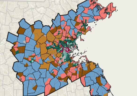
A housing submarket is a collection of neighborhoods—some next to each other, some not—with similar housing stock and housing market characteristics. These characteristics determine who can find, afford, and remain in suitable housing in that neighborhood. The neighborhoods in each submarket share common needs and challenges, regardless of geographic location. MAPC’s study revealed seven distinct housing submarkets in the Greater Boston region.

The Impacts of Land Use and Pricing in Reducing Vehicle Miles Traveled and Transport Emissions in Massachusetts
January 2021
Using a pair of established land use and travel behavior models, MAPC has forecast growth in vehicle miles traveled by 2030 under various scenarios, and estimates the relative impact of different land use patterns and pricing policies, alone and in combination with each other.

Evictions and COVID-19: The Responsibility of the Large Landlord
December 2020
The Boston Area Research Initiative (BARI) and the Metropolitan Area Planning Council (MAPC), in partnership with the City of Boston’s Department of Neighborhood Development, have studied evictions in the City of Boston in 2015-16, and what we have found can inform local, state, and federal response to the COVID-19 crisis.
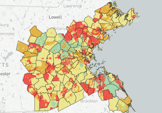
Introduction to the MAPC Zoning Atlas
December 2020
MAPC's Zoning Atlas, a resource nine years in the making, is the first regional zoning map since 1999 and the first to include information about multifamily housing, residential density, commercial density, and overlay districts. Even more important, it is being published as a dynamic online resource that will improve over time as municipal staff and other contributors refine the data and provide updates.
Read the introduction to the Zoning Atlas.

The Crisis Continues: The COVID-19 Layoff Housing Gap October Update:
October 2020
This research brief continues MAPC’s efforts to track COVID-19 unemployment and associated housing insecurity in Massachusetts. Combining this data from state agencies and the U.S. Census Bureau, we estimate the number of households affected by unemployment, whether they will be able to cover both rent and other basic expenses with their remaining income, and if not, what the monthly gap is.

The Diversity Deficit: Municipal Employees in Metro Boston
July 2020
This research brief uses self-reported demographic and occupational information compiled by the U.S. Census Bureau to assess the age, gender, and race/ethnicity demographics of municipal employees living in Metro Boston, a region encompassing 164 cities and towns.
In Greater Boston there are many reasons to be concerned about the demographics of our municipal workforce. As this research demonstrates, city and town employees are, as a whole, both older and Whiter than the region’s labor force, as well as its population.
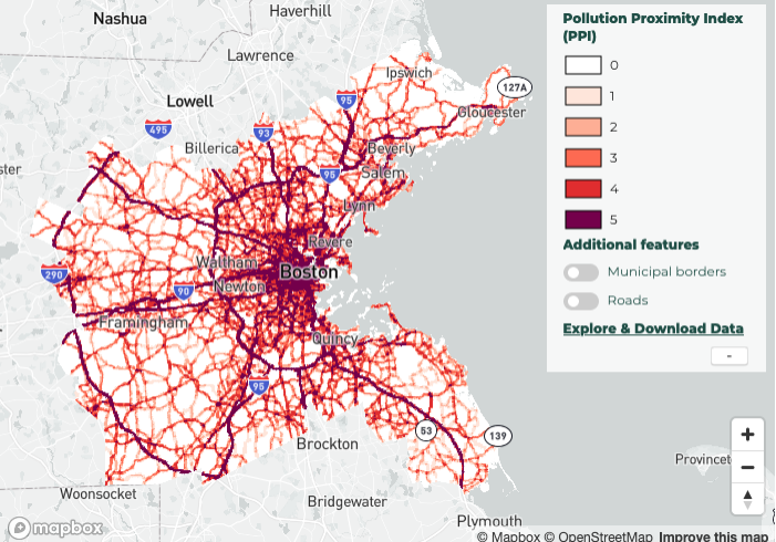
Racial Disparities in the Proximity to Vehicle Air Pollution in the MAPC Region
May 2020
Exposure to ultrafine particles (UFP) is strongly correlated with increased risks of developing cardio-pulmonary and other inflammatory diseases These illnesses, in turn, increase the risk of death for COVID-19 patients.
In the MAPC region, as elsewhere, road vehicles are a major source of local UFP emissions, and residents living near roadways with high levels of these emissions are exposed to significantly increased levels of UFP pollution. We performed an analysis to quantify the proximity of different populations to major sources of vehicle air pollution across the region. This report identifies key areas in the region where residents live close to large sources of vehicle pollution and quantifies the racial inequities that exist in pollution proximity.

Research Brief: The COVID-19 Layoff Housing Gap
April 2020
The United States and Massachusetts are experiencing an unprecedented crisis. Employees who are not “essential” or who can’t work from home are seeing drastically reduced work hours or are being laid off. The first wave of COVID-related unemployment included nearly 329,000 new claims in Massachusetts.
This analysis demonstrates that COVID-related unemployment has the potential to create a huge housing crisis in Massachusetts. Many households will need help after the one-time direct payments are exhausted. Many workers may not be eligible for federal assistance, or it may not arrive in time. Therefore, there is a need for the state and federal governments to take steps to ensure that workers are not displaced from their homes during this crisis.
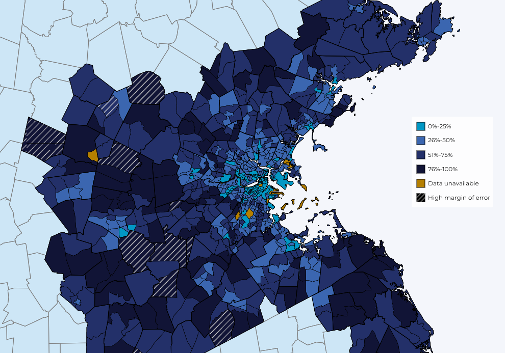
Crowded In and Priced Out: Why It’s so Hard to Find a Family-Sized Unit in Greater Boston
February 2020
MAPC set out to learn who is living in the “family-sized” units in 13 cities and towns in the region’s Inner Core. We looked at the number of people living in units with three or more bedrooms and the age of the head of household. We broke that information out by whether the unit is rented or owned, what kind of building it is in, and how these characteristics have changed over time. We also examined overcrowding in smaller units to better understand the full demand for larger places to live.

CLIMATE VULNERABILITY IN GREATER BOSTON
December 2019
A group's exposure to climate hazards, access to resources, and ability to plan for and rebuild after a climate event all factor into a group's vulnerability to climate change. This research examined the central question: Which populations are most vulnerable to the climate hazards that are likely to impact Metro Boston?
To answer this question MAPC constructed a regional climate vulnerability index that shows which neighborhoods in Metro Boston are more vulnerable to climate hazards than other. This mapping tool- which combines sociodemographic, public health, housing, and workforce data with climate exposure data- can be used to help identify which populations should be centered in climate preparedness and resiliency work.

FIRST MILES: Examining 18 Months of Dockless Bikeshare in Metro Boston
November 2019
Dockless bikes are an entirely new form of travel in the region, providing rapid mobility for local trips generally less than two miles. This report provides a first look at the data produced by the Lime dockless bike system which has been operating in the Boston region since Spring 2018, following a 2017 pilot program int he City of Malden. MAPC analyzed information about 300,000 trips to better understand how people are using the system to get around the region, and also to map where people are riding.

Perfect Fit Parking
July 2019
Parking, especially the amount of parking that should be required for new housing, is a hotly-debated issue in Metro Boston. Over the past three years, MAPC has set out to measure the actual supply and demand for residential parking in the Inner Core subregion, which includes Boston and 20 surrounding municipalities. We interviewed property managers and conducted overnight counts of parking spaces and parked cars at nearly 200 multifamily residential developments in 14 cities and towns. Overall, 30 percent of the available parking we surveyed was not being used. This research suggests not only is the over-building of parking in residential development wasting money and useful space, but the provision of abundant parking may also be counterproductive to local transportation goals for traffic and sustainability.

Share of Choices: Further Evidence of the Ride-hailing effect in Metro Boston and Massachusetts
May 2018
On May 1, Massachusetts regulators released a first-ever statewide picture of annual ride-hailing activity through a data set detailing the total number of trips by municipality and average trip length for the state. Coming shortly after the release of MAPC's Fare Choices report on ride-hailing passengers, these statistics provide additional evidence that a travel mode option that did not exist a decade ago is quickly altering travel patterns and choices throughout Metro Boston and Massachusetts.
Photo via Uber

Fare Choices: A Survey of Ride-Hailing Passengers in Metro Boston
February 2018
MAPC surveyed nearly 1,000 ride-hailing passengers in late 2017 and asked about their demographics, the nature of their trip, and why they chose ride-hailing over other modes of transportation.
The results confirmed many common assumptions about ride-hailing users; they also provided striking new insight into the ways that the services are changing travel behavior and affecting our existing transportation system.
Photo via Uber

The Waning Influence of Housing Production on Public School Enrollment
October 2017
One of the most widespread worries about new housing development, especially in suburban communities, is that it will drive up school enrollment. Many local officials and residents assume that new housing, and especially new multifamily housing, will attract families - families with children who will inevitably increase enrollment in the local public schools - creating additional education costs outweighing any new revenue the housing generates. MAPC examined housing permit and enrollment trends across 234 public school districts over the past 6 years and found no correlation between housing unit growth and enrollment change.
Read the Full Report

Regional indicators
Updated Spring 2017
Our Regional Indicators program is a set of measures that quantify our progress as a region in achieving the goals of MetroFuture.
MetroFuture, MAPC’s long-range vision for a more sustainable and equitable Metro Boston in the year 2030, includes goals that were established through community input and a collaborative stakeholder engagement process. By measuring our progress, we can identify where action or intervention are needed, and find opportunities for collaboration.
Explore our Regional Indicators

BUILDING FOR THE MIDDLE
Housing Greater Boston’s Workforce
September 2016
Across Metro Boston, there is a growing sense that the housing problems that one affected only low-income families are now affecting a greater number of households at higher and higher incomes. Many people fear that high housing prices are driving middle income middle-income families out of their neighborhood, and out of the region. To help shed light on these issues, the Data Services Research team analyzed household characteristics, income trends, and housing costs since 1990, with a focus on “middle income” households. We also projected the amount and type of housing that will be needed to accommodate new working households over the coming 15 years.

DIMENSIONS OF DISPLACEMENT
Baseline Data for Managing Neighborhood Change in Somerville’s Green Line Corridor
February 2014
This report, prepared in collaboration with the City of Somerville, Somerville Community Corporation, Somerville Transportation Equity Partnership, Friends of the Community Path, and Massachusetts Smart Growth Alliance is intended to help focus action on the strategies with the best potential to preserve a diversity of housing opportunities in Somerville.
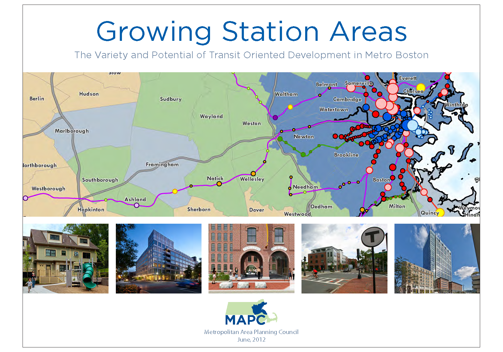
Growing Station Areas
Typology of transit station areas across Metro Boston and estimates of housing development potential
2012
This report presents a framework for evaluating transit-oriented development potential across the wide variety of transit station area contexts across the MBTA service region. It defines 10 different station area “types” and uses station- and type-specific assumptions to estimate housing and economic development capacity in each station.

Kids are Commuters, too
Assessing the Mode Shift Potential of Walk to School Programs in Massachusetts
2012
With support provided by the Barr Foundation, WalkBoston and the Metropolitan Area Planning Council (MAPC) developed a spatial framework for the following:
WalkBoston and MAPC recorded their findings and recommendations in the report Kids are Commuters Too: Assessing the Mode Shift Potential of Walk to School Programs.
- Assessing district- and school-level walkability
- New methods for collecting student commute data
- And a formula for estimating the GHG footprint of student auto commutes and the reductions that might be achieved by successful SRTS programs
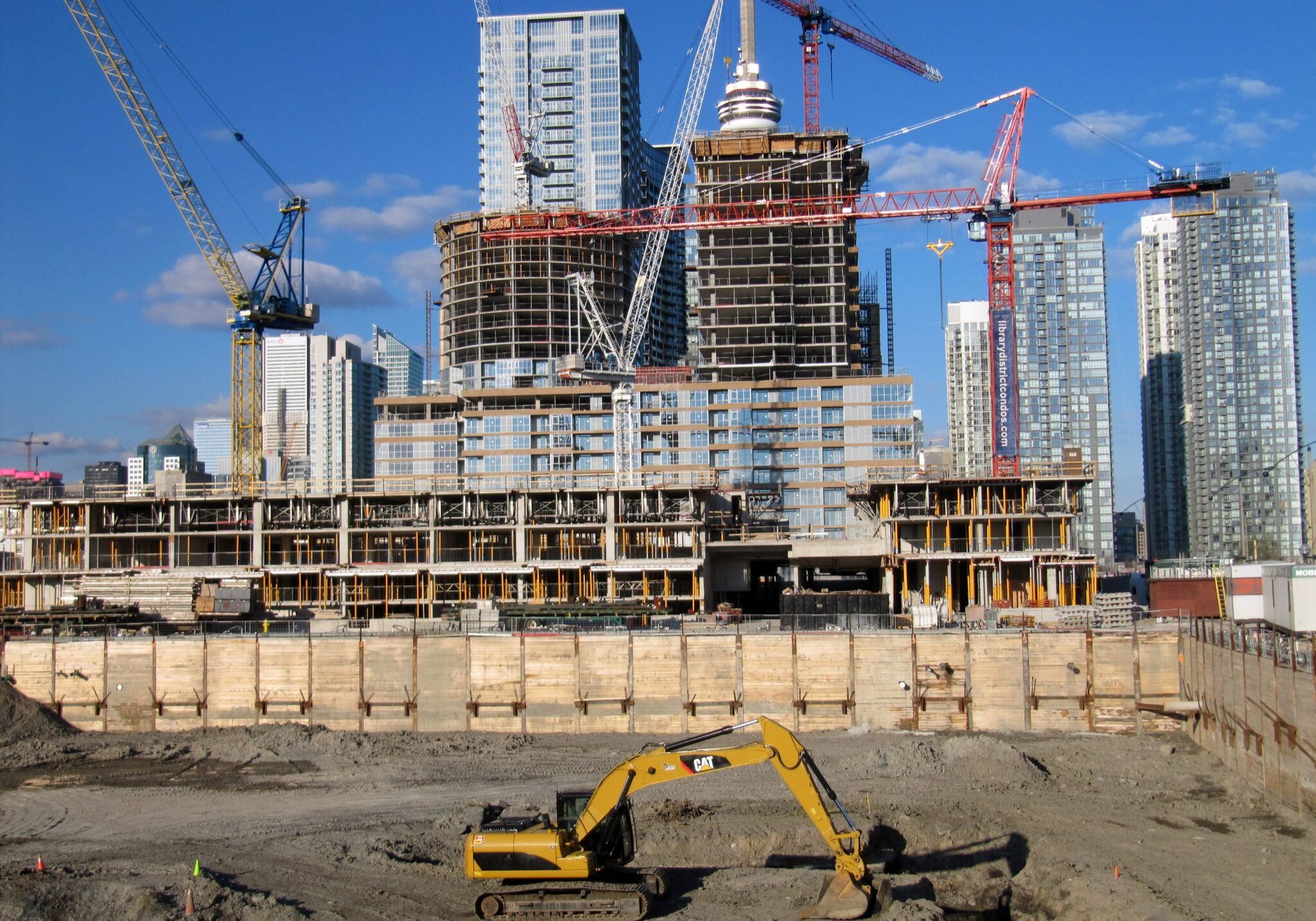
CONSTRUCTION INDUCED ENROLLMENT ANALYSIS
The Impact of School Construction on District Enrollment in Massachusetts Public Schools, 1996 – 2006
December 2009
MAPC Data Services analyzed the the impact of school construction on district enrollment in Massachusetts public school districts before and after major school construction or renovation projects that took place between 1996 and 2006. The primary goal of this effort, conducted for the Massachusetts School Building Authority (MSBA) was to ascertain whether enrollment increases after construction or renovation of a school facility above and beyond what would have been projected to occur in the absence of a construction event?
