Top

Fact Sheet: Vegetated Swales

Vegetated swales are an important Low Impact Development technique used to convey stormwater runoff. These open, shallow channels slow runoff, filter it, and promote infiltration into the ground; as a result, runoff volumes are smaller, peak discharge rates are lower, and runoff is cleaner. This approach contrasts with conventional stormwater strategies that rely on gutters and pipes that increase the velocity of runoff and do nothing for water quality.

Swales are not just ditches under another name—they must be carefully designed and maintained to function properly. The vegetation in swales, usually thick grass, helps to trap pollutants (suspended solids and trace metals), and reduce the velocity of stormwater runoff; stormwater also percolates through the natural substrate.

Vegetated swales can replace curb and gutter systems as well as storm sewers that convey runoff. Swales require more room than curb and gutter systems but they require less expensive hardscaping; furthermore, the reduction in discharge rate and volume means that downstream treatment facilities can be smaller. Swales also double as landscaping features, increasing the value and attractiveness of the site, as well as its appeal to neighbors and regulatory boards.

This swale in a residential neighborhood fits in with the landscaping. Photo: University of Connecticut, Jordan Cove Urban Monitoring Project

Management Objectives

  • Provide water quality treatment; remove suspended solids, heavy metals, trash.
  • Reduce peak discharge rate.
  • Reduce total runoff volume.
  • Infiltrate water into the ground.
  • Provide a location for snow storage.
  • Improve site landscaping.

Applications and Design Principles

Vegetated Swale Water quality swales are widely applicable on residential, commercial, industrial, and institutional sites. The amount of impervious cover in the contributing area to each swale should be no more than a few acres, and swales should not be used in areas where pollutant spills are likely. Grassed swales can be used in parking lots to break up areas of impervious cover. Roadside swales can be used in place of curb and gutter systems, except where there are numerous driveways requiring culverts. Where sidewalk and road are parallel, swale should be between the sidewalk and the road.

Swales can be used on commercial sites to convey runoff around the site and to help slow peak discharge rates.

Vegetated swales may be parabolic or trapezoidal in cross section. Longitudinal slopes should be as low as possible, and never more than 4%; swales should follow natural topography and drainage patterns to the extent possible. Swales work best in sandy loams that facilitate infiltration; very sandy soils may be prone to erosion under high runoff velocities. Check dams placed along the length of the swale can help to slow the runoff even more and promote greater infiltration and pollutant removal. Careful hydrologic design is necessary to ensure adequate pretreatment of the water quality volume and nonerosive conveyance of large storms.

Swales can be used on commercial sites to convey runoff around the site and to help slow peak discharge rates. Photo: Lower Columbia River Estuary Partnership

In some applications, swales are designed with a 2- to 3-foot deep soil bed of loamy sand to promote greater infiltration; on denser sites, this bed may include a perforated underdrain to ensure rapid drainage of the swale if groundwater infiltration is slow. In such applications, the runoff would end up (via the underdrain or swale termination) in the conventional stormwater system, but the swale would still provide considerable quality, quantity, and rate benefits.

Benefits and Effectiveness:

  • Swales help to control peak discharges by reducing runoff velocity, lengthening flow paths, and increasing time of concentration.
  • Infiltration through the natural substrate helps to reduce total stormwater runoff volume.
  • Swales provide effective pretreatment for downstream BMPs by trapping, filtering and infiltrating particulates and associated pollutants. The design rate for TSS removal is 70%.
  • Swales accent the landscape and may help to satisfy landscaping and greenspace requirements.
  • Swales can provide a location for snow storage during winter months.
  • Roadside swales effectively keep stormwater flows away from street surfaces.
  • Construction may cost less than conventional curb and gutter systems.

Limitations

  • Each grassed swale can treat a relatively small drainage area of a few acres, depending on land use and soil type. Large areas should be divided and treated using multiple swales.
  • Swales are impractical in areas with steep topography.
  • A thick vegetative cover is needed for these practices to function properly. Grass must not be mowed too short.
  • Swales should be used carefully on industrial sites or areas of higher pollutant concentrations. If used, they should be part of a “treatment train” that includes other treatment BMPs.
  • Swales can be subject to channelization, if erosive velocity is exceeded.
  • Soil compaction can reduce infiltration capacity.
  • Swales are not effective at reducing soluble nutrients such as phosphorous.
  • In some places, the use of swales is restricted by law; many local municipalities may require curb and gutter systems in residential areas.

Maintenance

Permits for water quality swales should specify schedules and responsibility for inspection and maintenance. Since swales may be located on private residential property, it is important for developers to clearly outline the maintenance requirements to property purchasers.

  • Inspect on a semi-annual basis; additional inspections should be scheduled during the first few months to make sure that the vegetation in the swales becomes adequately established. Inspections should assess slope integrity, soil moisture, vegetative health, soil stability, compaction, erosion, ponding, and sedimentation.
  • Mow at least once per year, but do not cut grass shorter than the design flow depth because the effectiveness of the vegetation in reducing flow velocity and pollutant removal may be reduced. Grass cuttings should be removed from the swale and composted.
  • Remove accumulated sediment when it is 3” deep or higher than the turf, to minimize potential concentrated flows and sediment resuspension.
  • Irrigate only as necessary to prevent vegetation from dying.
  • The application of fertilizers and pesticides should be minimal.
  • Reseed periodically to maintain dense turf.
  • Remove trash or obstructions that cause standing water.
  • Prevent off-street parking or other activities that can cause rutting or soil compaction.

Cost

Vegetated swales typically cost less to construct than curbs and gutters or underground stormwater conveyance pipes. The cost of construction will depend on local conditions and management objectives. As with any stormwater management structure, property owners should provide a budget for ongoing maintenance, such as regular mowing and repairs as necessary.

Design Details

  • The topography of the site should generally allow for a longitudinal slope of no more than 4% and no less than ½%. Flatter slopes can result in ponding, while steeper slopes may result in erosion (depending on soil type, vegetation, and velocity.) Use natural topographic low points and drainageways to minimize excavation.
  • Underlying soils should be a sandy loam or a similar soil type with no more than 20% clay. Soil augmentation may be necessary.
  • Side slopes should be 3:1 or flatter for maintenance and to prevent side slope erosion. Swale bottoms should generally be between 2 and 8 feet in width.
  • Use pea gravel diaphragms for lateral inflows.
  • Check dams can be utilized to establish multiple cells. Check dams at 50-foot intervals (<2’ drop) help to maximize retention time, increase infiltration, promote particulate settling, and decrease flow velocities. Check dams are not necessary with very low longitudinal slopes. Provide for scour protection below check dam.
  • Outlet protection must be used at any discharge point from swales to prevent scour.
  • Select grass species that produce fine, uniform, and dense cover and that can withstand prevailing moisture conditions.
  • Temporary erosion and sediment controls should be utilized during construction.
  • Keep heavy equipment out of the channel during construction to minimize compaction. Even a bobcat grader can compact soils and reduce potential infiltration. Use excavator with a swing arm and work from the side of the swale.
  • Mulch anchoring should be done immediately after seeding.

Additional References:

  • The Massachusetts Stormwater and Technical Handbook (Volume 2) provides design details for vegetated swales. The handbook can be found on the MA DEP stormwater publications page, along with other useful stormwater publications.
  • Grassed Swales; from The Wisconsin Stormwater Manual, University of Wisconsin-Extension Service; 2000

Download a print-ready PDF version of this document below. To request hard copies of this document, please e-mail [email protected].

Continue reading...

Shared Parking

Parking Spaces Serving Multiple Masters

Shared parking means that a parking facility serves multiple destinations. This requires multiple destinations within walking distance of the same parking facility, and is most effective when those destinations either share patrons, so that people park once and visit multiple destinations, or have different periods when parking demand is highest. Shared parking is usually an intrinsic part of downtown settings where there is public parking because the same parking facility serves many different destinations within walking distance (promoting public rather than private parking facilities is covered further under fees-in-lieu). Shared parking is also effective in mixed use developments, either when there is a mix of uses on a single site or when sites with different uses are located suitably close together. One example of this is an office building sharing parking with a restaurant or movie theater, since most of the office workers (and their cars) will be gone in the evenings when there is the most demand for parking from the restaurant or theater. A table showing typical peak parking periods of various land uses is below [1].

Land Uses by Time of Peak Parking Demand Weekday Evening Weekend

Land Uses by Time of Peak Parking and Demand
Weekday Evening Weekend
Banks and public services

Offices and other employment centers

Park & Ride facilities

Schools, daycare centers and colleges

Factories and distribution centers

Medical clinics

Professional services

Auditoriums

Bars and dance halls

Meeting halls

Restaurants

Theaters

Hotels

Religious institutions

Parks

Shops and malls

This table indicates peak parking demand for different land use types. Parking can be shared efficiently by land uses with different peaks.

By allowing for and encouraging shared parking, planners in communities with minimum parking requirements can reduce the required number of parking spaces for mixed use developments or single-use developments in mixed-use areas. Establishing the number of spaces required in a shared parking situation requires consideration of a number of factors:

  • The physical layout of the development (especially ease of pedestrian access from the parking spaces to the different uses);
  • The type of users typically parking at each type of facility, and their parking patterns (e.g. employees who park for a full day vs. customers who park for an hour or two); and
  • The total accumulation of parked vehicles expected for each use during different time periods.

Many shared parking regulations use the method below to determine the minimum number of spaces required for a shared parking facility (view an example):

  1. Determine the minimum amount of parking required for each land use or destination by time period as if it were a separate use
  2. Sum the number of required parking spaces in each time period across all uses
  3. Set the minimum requirement at the maximum total across time periods.

Others allow the parties sharing the parking to determine the appropriate number of spaces. The Urban Land Institute has published a report entitled Shared Parking, which offers analytic methods and time-of-day parking utilization curves for local governments and developers to calculate parking needs for specific projects.

One challenge with shared parking is working out an agreement between land owners or developers if the uses are not all on the same property. The municipality may wish to provide a model agreement that the parties can use (see Portland, OR example below).

Local examples:
  • The City of Marlborough allows shared parking in all districts for uses with different peak periods, allowing reductions of up to one-half of the minimum parking required for the uses separately. The city requires documentation of the reduced parking demand as well as additional provision of open space for each parking space not provided as a result of shared parking.
  • In the City of Waltham, the parking requirement for any mixed use parcel or building is calculated based on the method given above. The ordinance provides the time table of parking requirements by use.
  • The Town of Stoneham allows shared parking by special permit with the approval of the Planning Board. Up to 50% of required spaces may be shared with uses having different operating hours. The parties must sign a joint use agreement.
National examples:

Metro, the regional governmental agency for Portland, Oregon, developed a handbook on shared parking for their region, including a model shared parking bylaw and a model shared parking agreement. While parts of it are specific to Oregon, much of it provides a useful template for developing a shared parking bylaw generally. Download:

Additional Resources:

  1. Todd Litman, Parking Management: Strategies, Evaluation, and Planning, Victoria Transport Policy Institute, April 2006; p. 12. Available as a free download from https://www.vtpi.org/park_man.pdf or by clicking here.
  2. Mary S. Smith, et al., Shared Parking Second Edition (2005). Available for purchase from the Urban Land Institute Bookstore (https://www.uli.org/Books.aspx).
  3. Stein Engineering, Shared Parking Handbook, Portland Metro, January 1997. Click here for the PDF.
  4. Victoria Transport Policy Institute, “Shared Parking”, Online TDM Encyclopedia: https://www.vtpi.org/tdm/tdm89.htm.
  5. Maryland Governor’s Office of Smart Growth, Driving Urban Environments: Smart Growth Parking Best Practices, March 2006; p. 6-7. Available as a free download
  6. U.S. Environmental Protection Agency, Parking Spaces / Community Places: Finding the Balance Through Smart Growth Solutions, January 2006; p. 18-20. Available as a download
  7. Georgia Quality Growth Partnership, “Shared Parking”, Quality Growth Toolkit: https://www.dca.state.ga.us/toolkit/ToolDetail.asp?GetTool=49.
  8. Institute of Transportation Engineers, Shared Parking Planning Guidelines (1995). Available for purchase from ITE
  9. Fitzgerald & Halliday, Inc., Northwest Connecticut Parking Study – Phase II: Model Zoning Regulations for Parking for Northwestern Connecticut, Northwestern Connecticut Council of Governments and Litchfield Hills Council of Elected Officials, September 2003; p. 21-22. Available as a free download from https://www.fhiplan.com/PDF/NW%20Parking%20Study/NW%20Connecticut%20Parki… or by clicking here.
  10. Christopher V. Forinash, et al., “Smart Growth Alternatives to Minimum Parking Requirements”, Proceedings from the 2nd Urban Street Symposium, July 28-30, 2003. Available as a free download from https://www.urbanstreet.info/ or click here for the PDF.
  11. American Planning Association, Smart Codes: Model Land Use Regulations: Model Shared Parking Ordinance. Available from American Planning Association.
Continue reading...

Mixed Use Zoning Toolkit (March 2006)

Prepared by the Metropolitan Area Planning Council with support from The Minuteman Advisory Group on Interlocal Coordination (MAGIC) and the Commonwealth’s Priority Development Fund

This basic guide to mixed use zoning presents the fundamentals you need to plan a mixed use bylaw:

This guide is based primarily on the experiences of five suburban communities that have prepared bylaws with assistance from the Metropolitan Area Planning Council (MAPC), supported by grants from the state’s Priority Development Fund. MAPC also investigated the mixed use experiences of other communities in the region and elsewhere in the state. Preparation of this guide, a companion guide and technical appendix for citizens, and many of the public education materials used to shape the bylaws and educate the public were developed with additional funding from the MAGIC subregion [1].

[1] MAGIC – the Minuteman Advisory Group on Interlocal Coordination – is a subregion of the Metropolitan Area Planning Council (MAPC). MAGIC consists of officials from Acton, Bedford, Bolton, Boxborough, Carlisle, Concord, Hudson, Lexington, Lincoln, Littleton, Maynard, and Stow.


Continue reading...

Commercial Permit Parking

Employee / Commercial / Business Parking Permits: Simplifying and Regulating Employee Parking

There are several reasons why a community might want to create an employee parking program for the downtown or business district, such as employees parking in prime on-street spaces, having difficulty finding parking, or having to shuffle their cars repeatedly for lack of all-day parking. Employee parking programs may include establishing designated lots or portions of parking facilities for employees with a permit program to restrict use and/or requiring employees to register their cars so that if they park in valuable on-street spaces they can be ticketed. Employee parking areas are generally less conveniently-located than other parking but allow all-day parking and where parking is priced offer a discounted rate. This encourages employees to leave the most convenient spaces for customers. To encourage employees to carpool or not to drive at all, employee permit parking programs can be combined with preferential parking for carpools and vanpools; special deals for employees on transit passes if public transportation is an option; and/or provision of secure, covered bike parking downtown suitable for all-day use.

While designated employee parking can help alleviate demand for on-street parking, it can mean that designated employee parking facilities are used only during work hours. If demand for parking downtown is substantially lower on evenings and weekends, this may not be a concern. However, if uses such as restaurants, bars, and stores are generating demand for parking outside of business hours, it may make sense to limit the hours during which the employee parking is reserved for permit-holders (e.g. 7AM to 7PM) and allow anyone to use it outside of those hours.

In larger cities, if parking demand is especially high during work hours, it may make sense to establish employee parking facilities on the outskirts of downtown or business districts and provide shuttle service to the core (see remote parking and shuttle service).

Local Examples:
  • The Town of Lexington has an employee permit parking program for Lexington Center that provides lower-cost parking around the outskirts of the downtown for employees in order to free up meter spaces for visitors. Permits cost $225-250 for the year, depending on the lot. For more information, see https://ci.lexington.ma.us/DPW/parkingpermits.cfm.
  • The Town of Brookline has a commercial parking permit program with a limited number of spaces for businesses in Coolidge Corner and Brookline Village commercial areas. One program allows qualified businesses to purchase a pass guaranteeing a space in an unmetered lot, with a maximum of 2 per business. The other simply gives a hang tag to businesses that allows employees to parking in metered spaces all day, but they must still pay the meter fees plus a small annual fee. The Town encourages employees to use other modes to get to work so that parking is available for customers. For more information, see https://www.town.brookline.ma.us/transportation/parking/commercialparking….
  • The Town of Amherst has Town Center permit parking area that provides permits to people living or working within the designated area. Employers and employees may obtain one vehicle permit per person, and eligible employers or employees may obtain two permits for two vehicles. Employers in the Town Center are also eligible to obtain one visitor pass for their place of employment. Fees are $35 for a single permit, $45 for two vehicles, and visitor passes are free for the first 30 days with a standard permit and $1/day for other passes up to an annual maximum of 60 days. For more information see https://www.amherstma.gov/departments/Parking/Parking_regulations.pdf.
National Examples:
  • Davis, California has a variety of parking permits targeted to employees and businesses downtown. Most allow all-day parking for employees in streets around the edges of downtown. Prices range from $10 to $75 a year depending on the permit area. Hours for permit restrictions vary, starting at either 6 or 8 AM and ending at either 6 or 10 PM. For more information see https://www.davisdowntown.com/parking/employee/.
  • The City of Portland, Oregon has an Area Parking Permit Program for areas without meters that has both a residential and a business component. It allows all-day parking for those who live or work in a designated district, and restricts others to a visitor time limit. All Business permits cost $35 for the year. For more information see https://www.portlandonline.com/transportation/index.cfm?c=38744.
Continue reading...

Residential Permit Parking

Keeping Neighborhoods Free of Unwanted Cars

If parking demand from a transit station or commercial area is spilling over into surrounding neighborhoods and preventing residents from parking there or making it impossible for invited guests to find parking, there may be a need to regulate who can use the on-street parking when. This is commonly done through the use of residential parking permits. Residential Permit Parking programs vary widely in their details, including:

  • Permit fees;
  • Limits on number of permits issued;
  • Implementation criteria; and
  • Visitor parking accommodation.

Most major cities in the US have some sort of residential permit parking program (a May 2006 parking study by Nelson-Nygaard conducted for the Downtown Brooklyn Council examines several: https://download.brooklynchamber.com/DBC/Brooklyn_Residential_Permit_Park…). In Massachusetts, a number of more urban communities have permit programs for residents in some or all of the community, including Boston, Cambridge, Somerville, Everett, Brookline, and Amherst. (For more information on these programs and a comparison of their details, click here.) All of the programs are designed to give residents priority in parking in their community or their neighborhood where non-resident parking has been compromising resident access to on-street parking. The programs are either structured so that any resident of the community may obtain a permit that is valid for any permit parking area within the community, or so that only residents of a given neighborhood may obtain a permit to park in their neighborhood. None of the programs is intended to restrain demand for resident parking. The Town of Brookline’s permit parking program does not extend to overnight parking on the street, which is prohibited for all vehicles (with a 1-hour time limit). The Town has a separate resident overnight parking program that rents out parking spaces in town-owned parking lots and at the Courtyard Marriott Hotel to residents for a price of $100 a month, and a separate program to permit owners of private lots to rent their spaces for overnight parking. The relatively high cost of these overnight parking spaces may restrain demand for resident parking where off-street parking is not available.


Permit Fees

The residential permit programs in Massachusetts all have quite low fees, from free to $20 for the year. Massachusetts state law regulates how much a municipality can charge for residential permits, limiting the price of the permit to a statutorily-defined amount or the cost of issuing the permit. This means that the permit price cannot be used to restrain demand for resident parking under current state law. In addition, the City of Cambridge (and likely others as well) has found it politically unpalatable to deal with demand for parking by increasing the price for existing residents. In other cities, permit fees can run as high as $60 a year (San Francisco) or over $100 for the year (Toronto, Canada). Some places structure fees so that 2nd and 3rd permits for a household are more expensive (Brookline actually charges less for subsequent permits to the same household), and/or so that those with off-street parking available pay more. [1] For example, in Alexandria, Virginia, residential parking permits cost $15 for the first vehicle, $20 for the second vehicle, and $50 for each additional vehicle (see https://alexandriava.gov/finance/info/default.aspx?id=1818 for more information). This discourages households from having many cars parked on the street.

Limits on Permits Issued

In Boston, residential parking permits essentially serve as a “hunting license” for parking, because there are many more cars with permits than residential permit spaces available. There are no limits on how many permits an individual or household may obtain – the only limit is that one permit is issued per eligible vehicle. The same is true in several of the other communities as well, though the discrepancy between permits issued and spaces available is less severe. Brookline does limit permits to 4 per address, but this is unlikely to actually constrain many households. Amherst allows one permit per resident, which again is unlikely to constrain the number issued significantly, if at all. By contrast, the City of Toronto limits the number of permits issued to the number of permit spaces in the district, and uses a waitlist to issue permits once the quota has been reached (residents with multiple permits may be forced to give up a permit to someone on the wait list who doesn’t have any). Washington D.C. is currently prevented from limiting the number of permits issued by legislation, but changes are actively being sought to that legislation. [1]

Implementation Processes

Residential Permit Parking programs are frequently initiated at the request of residents. In most cases, a certain number or percentage of the neighborhood or community residents must sign a petition or otherwise express support for a permit parking program. Boston, Somerville, and Brookline all have policies requiring 50-51% of residents or households to support the program. Brookline has additional criteria related to the size of the district proposed and the current occupancy level of on-street parking. Other American cities set higher thresholds for resident support: Seattle requires 60% of households’ support, Philadelphia requires 70%, Minneapolis 75%, and Chicago 80% [1].

Visitor Parking

Accommodating visitor parking on a temporary basis can benefit both residents with cars and those without, and may be instrumental in getting the support of residents without vehicles, who otherwise are inconvenienced more than benefited by a residential permit parking program. Residents without cars may occasionally rent or borrow cars, and need a place to park them. In addition, all residents may want parking for occasional invited guests. The City of Boston makes no provision for visitor parking, but it is one of few cities where that is true. Brookline also has no visitor permit for on-street parking, but anyone can park in the permit districts for up to 2 hours, and no one can park on the streets overnight; there are guest overnight parking passes that can be used for certain municipal off-street lots, and cost $10 per night. In Cambridge and Somerville, guest parking passes are available to residents for a nominal fee (or in some cases free with purchase of a resident permit), but have restrictions on how often or for how long they can be used. In Everett and Amherst, the cost of the guest pass depends on how many days are included, and there are maximum limits on the total number of days. (See comparison table for specifics.) For cities around the country, the cost of visitor passes ranges from nothing at all to $15 per week, and the limit for duration of use ranges from 1 day to 16 weeks, and some cities have no limit [1].

Sources:

  1. Nelson-Nygaard Consulting Associates, “Downtown Brooklyn Residential Permit Parking Study”, prepared for the Downtown Brooklyn Council, May 2006. Available online at https://download.brooklynchamber.com/DBC/Brooklyn_Residential_Permit_Park….
  2. Local parking programs:
Continue reading...

Maximum Parking Allowances

Limiting Parking Supply

Parking Maximums establish an upper limit on parking supply, either at the site level or across an area. Limits imposed by district or neighborhood are called “Parking Caps”. Either type of maximum can be imposed in addition to or instead of minimum parking requirements. Establishing a maximum allowable amount of parking can prevent developers from building excessively large lots, or limit the parking supply in an area based on roadway capacity or community priorities. Communities looking to increase tax revenue through redevelopment of parking lots, improve pedestrian safety and comfort downtown, or reduce stormwater runoff and heat island impacts of parking may want to consider parking maximums as a way to achieve those goals.

Either type of parking maximum can pose implementation issues, however. Setting a maximum leaves little room for error in projecting parking demand. Area-wide parking caps also leave little room for error and require substantial effort in planning and administration to determine the appropriate number of spaces and to allocate them to specific development projects. Furthermore, a restricted parking supply can present problems with spillover effects if not implemented carefully. Resident permit parking or other solutions to mitigate spillover effects and availability of other transportation options can improve the chances of success. Developers may also worry about the long-term marketability of the site if parking is restricted. If parking is restricted throughout an area, then the site will not be less competitive than surrounding sites. Restricting the parking supply may seem to put a community at a competitive disadvantage, and only makes sense in places where the benefits, such as rapid transit service, attractive pedestrian environments, or concentrations of businesses and services, outweigh any inconvenience from reduced parking.

To improve flexibility, planners can set up the parking maximums as transferable parking entitlements, so that the allowed number of parking spaces can be transferred or sold to another development if they are not needed. This allows for area-wide control of parking supply without restricting developments that need more parking. Developments requiring less parking can benefit by selling the rights to their additional spaces. [1]

Local examples:
  • The Town of Burlington lists both maximum and minimum parking requirements for most uses throughout the town (see regulation).
  • The City of Somerville provides parking maximums (in addition to minimums) for the Assembly Square Mixed Use District and the Planned Unit Development-A Overlay District that will go into effect when a new MBTA station is operational there (see regulation).
  • The City of Cambridge has caps on the number of off-street parking spaces that may be provided within certain Special Districts and maximums for certain uses throughout the city.
  • The Town of Belmont has maximum numbers of parking spaces allowed for each subdistrict of the McLean Hospital property and in the Belmont Uplands District (without parking minimums) (see regulation).
  • The Town of Bedford has maximum parking allowances for certain uses throughout the town (see regulation).
  • “In 1977, the City of Boston adopted a freeze on commercial parking open to the public, but not parking reserved for individuals or a company use within office buildings. While the number of commercial spaces have not increased, there was a 26% increase in exempt spaces between 1984 and 1987 alone and motor vehicle traffic increased dramatically along major corridors to the city.” [4]
National examples:
  • “In 1975, the City of Portland set an overall cap of approximately 40,000 parking spaces downtown, including existing and new parking facilities. The cap was increased to about 44,000 spaces by the 1980’s and increased again in the 1990’s. The City is generally satisfied with its parking policies and believes it has helped increase transit use from 20-25% in the early 1970’s to 48% in the mid-1990’s.” [4] In addition, Portland sets maximum parking limits based on type of use and availability and frequency of transit service, and allows transfer of unused parking entitlements. [1]
  • San Francisco limits parking downtown to 7% of the building’s floor area. [2]
  • Seattle allows a maximum of one parking space per 1,000 square feet of office space downtown, and is considering extending this limit to areas outside of downtown as well. [2]
  • Redmond, Washington, a suburban community, allows a minimum of 4 and a maximum of 5 spaces per 1,000 square feet of floor area for most uses in the Neighborhood, Retail, and General commercial zones. [3]
  • Helena, Montana establishes maximum parking ratios as a percent above the minimum parking ratio (e.g. no more than 110% of the minimum for parking lots of more than 51 spaces). [3]

Additional resources:

  1. U.S. Environmental Protection Agency, Parking Spaces / Community Places: Finding the Balance Through Smart Growth Solutions, January 2006; p. 16-18. Available as a free download at https://www.epa.gov/smartgrowth/parking.htm, or click here for the PDF.
  2. Maryland Governor’s Office of Smart Growth, Driving Urban Environments: Smart Growth Parking Best Practices, March 2006; p. 5-6. Available as a download.
  3. Jason Wittenberg, “Parking Standards in the Zoning Code“, Zoning News, January 2003, p.3.
  4. Victoria Transport Policy Institute, “Parking Maximums”, Online TDM Encyclopedia: https://www.vtpi.org/tdm/tdm28.htm#_Toc128220478.
  5. Todd Litman, Parking Management: Strategies, Evaluation, and Planning, Victoria Transport Policy Institute, April 2006; p. 15. Available as a free download from https://www.vtpi.org/park_man.pdf or by clicking here.
  6. Fitzgerald & Halliday, Inc., Northwest Connecticut Parking Study – Phase II: Model Zoning Regulations for Parking for Northwestern Connecticut, Northwestern Connecticut Council of Governments and Litchfield Hills Council of Elected Officials, September 2003. Available as a free download from https://www.fhiplan.com/PDF/NW%20Parking%20Study/NW%20Connecticut%20Parki… or by clicking here.
  7. Christopher V. Forinash, et al., “Smart Growth Alternatives to Minimum Parking Requirements“, Proceedings from the 2nd Urban Street Symposium, July 28-30, 2003. Available as a free download from https://www.urbanstreet.info/ or click here for the PDF.
Continue reading...

What is the Best Process to Plan Mixed Use Zoning?

In the communities we studied closely, mixed use was recommended in local Master Plans, Comprehensive Plans, Community Development Plans, or other studies. The plans themselves were the product of substantial public participation, involving the buy-in of local officials, planners, developers, property and business owners, and other interested citizens. The towns then officially adopted the plans. Thus they began with some community expression of a will to move forward with mixed use as one of a number of strategies to improve future development.

Going from concept to location-specific plans is often a challenge, evoking fears and strong emotions. It is wise to keep people involved in the process as the bylaw evolves and get their input into both the overall concept and the details. Participation by potential developers and existing property owners is especially important in shaping the bylaw.

One way to engage the community is to do a Visual Preference Poll to show examples of mixed use and gather citizen feedback on what they like and don’t like. To do this, we compiled a Powerpoint presentation showing examples of mixed use in the region. We asked residents to vote for those they would like to see in the areas being considered for mixed use in their community. We then went back through the presentation and asked them to identify the features they liked and the features they did not like. Some of the examples appear in this guide. A sample Visual Preference Poll is also available on CD-ROM for use in your community.

The Visual Preference Poll is useful in gathering input about building heights, massing, materials, style, pedestrian amenities, signage, and other close-in features. It does not readily gauge the larger context, the mix of uses, the relationship among different structures and uses, multi-building landscaping and design features that create connectivity and pedestrian flow, or parking areas relative to multiple locations.

Mixed Use Practice

New Mixed Use in Canton The five communities we worked closely with are Bedford, Millis, Southborough, Stoughton, and Stow, all suburban and some quite small. We also reviewed the experiences of other communities, most notably Canton, where a mixed use bylaw passed and a new development, with housing, retail, and offices, was built near the Canton Center Rail station.
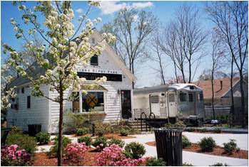
Specific areas in each town were chosen for a variety of reasons. Some, like Depot Park in Bedford, already had some improvements but also had ripe revitalization potential. Bedford's Depot Park Improvements
Bedford Opportunities Others, like the Lower Village area in Stow, are places where housing and a mix of uses would create more of a village atmosphere and improve the “gateway” potential of this main route into town.
In most cases, the vision is to create a vibrant and attractive village-style area with a lively mix of housing, retail, restaurants, offices, and other compatible uses. Stow Lower Village
Vision for the Village Center at the Former South Weymouth Naval Air Station

Although the Visual Preference Poll is useful in shaping certain aspects of the bylaws, especially the design standards, you will need to supplement it with additional discussion of a range of issues, many of which are presented below.

It is critical that these issues be aired fully and resolved in advance of consideration on the floor of Town Meeting or before Town or City councils.

Continue reading...

What Should You Consider in Drafting a Bylaw?

Using an Overlay District vs. Changing Underlying Zoning

An “overlay” district is a zoning district that is superimposed over one or more existing districts in order to impose additional restrictions, permit additional uses, or implement density bonuses or incentive zoning to achieve community goals. In the case of mixed use zoning, it is used to allow added uses and to provide incentives to achieve local goals. Thus developers can develop either according to the underlying zoning or according to more flexible mixed use provisions.

The overlay, as we have noted, encourages coordinated, cohesive development across lots or through lot consolidation. Rather than allowing piecemeal development, it encourages a sense of place over a larger area. The overlay allows the community to enable and require a mix of uses and to control their features. Changing the underlying zoning to allow a mix by right would only enable the mix but would not require it nor would it control it via the special permit process. The overlay concept is especially useful where the desired mixed use area crosses zoning district boundaries or includes only a piece of a district or where the community wishes to protect commercial or industrial uses in parts of a district.

Selecting the Permit-Granting Authority

Mixed use proposals should be reviewed and authorized by a board with substantial planning expertise and the ability to act with relative speed. The longer and less predictable the approval process, the less likely it is that developers will choose the mixed use route. Most of the communities in our study selected the Planning Board as the most appropriate review and approval body. The Planning Board generally has more design and development negotiation experience than the Zoning Board of Appeals. The Planning Board process is substantially less cumbersome, more expeditious, and more consistent and predictable than Town Meeting. In some communities, however, the Zoning Board traditionally grants special permit and residents may be more comfortable with that arrangement. In this guide, we simply refer to the permit-granting authority as “the board.”

Balancing Incentives and Requirements

To encourage developers to use the mixed use option, the bylaw needs to include incentives and provide for community control while avoiding excessively burdensome requirements. It is easy for local boards to be carried away by utopian visions of the ideal development, but if the bylaw raises too many hurdles it will never be used.

The choice of incentives and requirements should be based on the community’s goals and the purpose of the bylaw. A town that is primarily trying to promote revitalization, for example, may have less stringent housing requirements than one where affordable housing is a primary goal. Thus the proposed Bedford bylaw, geared toward revitalization, requires 10 percent affordable housing in developments of eight units or more while Southborough, where affordable housing is a key goal, is considering 20 percent in developments of four units or more.

The choice of incentives should also consider what is most likely to appeal to developers in the areas under consideration. Communities may choose from a number of potential incentives, such as:

  • The ability to build certain kinds of housing (e.g., multi-family or small units) where it is not otherwise allowed
  • More flexible design standards
  • Less open space where flexibility produces better design
  • Less parking, provided that adequate parking is achieved through such alternatives as shared parking arrangements; higher reliance on public transportation, bicycling, or walking; or transportation demand management techniques
  • Streamlined permitting

In balancing incentives and requirements, it is important to remember that the community retains control through the special permit process. The special permit ensures high quality design. The board may always say no or negotiate more desirable design.

Setting the Tone and Establishing the Scope

Mixed use is intended as an improvement over traditional, segregated-use zoning. It often derives from a positive vision of a more desirable community. The bylaw should help set this tone, emphasizing what the developer can do while limiting prohibitions. Sometimes even a prohibition can be affirmatively phrased; “up to” 40,000 square feet sounds more affirmative than “no more than” 40,000 square feet.

The bylaw should spell out its purposes, goals, and benefits and may include positive performance criteria and design standards. The bylaws in our study rely heavily on these components to set the tone and to give the board the tools to support good design.

Application procedure requirements and document submission information should go at the end of the bylaw, appearing after the reader is engaged by the mixed use concept. In general, those bylaw provisions that mirror other local bylaws should simply refer to the applicable sections without repeating the details.

Selecting the Areas and Boundaries

Our study communities selected for mixed use those areas where

  • Run-down properties were prime candidates for redevelopment;
  • Existing zoning limited creativity; and/or
  • Village-style development would improve community character.

Some of the most underutilized or unattractive sites are currently zoned for industrial uses. Communities are faced with a challenge in dealing with these sites. On the one hand, the properties could be much more attractive as village-style mixed use development. On the other hand, industrial property is a limited but necessary resource, and there is some reluctance to give it up. These competing factors will play themselves out in the selection of areas and their boundaries.

Establishing boundaries for mixed use districts is very site-specific. In general, boundaries should be selected to protect desirable existing uses and properties and to ensure smooth transitions to surrounding areas.

Some communities, such as Southborough, chose to start small with the hope of potentially expanding later. Other communities, such as Stow, selected larger areas, incorporating “A” and “B” subareas to ensure a gradual transition to and from the neighboring residential areas.

As with the other issues outlined here, the choice should be based on substantial input from local officials, property owners, developers, abutters, and other citizens.

Achieving Good Design

Many of these elements of good design apply to all development, and it is beyond our scope to discuss them all here. However, certain aspects seem especially relevant to mixed use and thus are included here.

Variations in Approach

There are two basic ways communities can regulate the design of new development, whether mixed use or single use. One is to set specific density standards such as units per acre, floor area ratio, or percent lot coverage limits. The other is to establish more general design criteria and performance standards and use the special permit process to negotiate the outcomes. In this latter approach, parking and water and sewer infrastructure, along with design elements such as connectivity, walkability, and architectural features, are used to guide development.

In the case of mixed use, several of our study communities have opted to omit specific density standards in the belief that greater flexibility will lead to better design. This approach seems in keeping with the vision of mixed use as more flexible, innovative, and context-sensitive than traditional zoning. The approach is open to debate. Some believe that density itself is seldom the problem; bad design is. Others say that citizens need more assurance that development will not be too dense and developers prefer clearer rules. Knowledge of your community’s predilections will help you gauge which approach is most appropriate. A compromise might be to limit density but allow it to go higher under certain circumstances or to cap the total number of units over a given number of years.

Design Features in a Mixed Use Setting

Balanced mix of uses: To be successful, a mixed use district should include a balanced and vibrant mix of compatible uses, with first floor street-front uses generally reserved for retail, restaurant, and in some cases office uses. The proposed bylaws in our study communities encourage this mix by regulating first-floor street front uses and by incorporating a goals and performance criterion that considers a development’s mix and its impact on the existing mix. Thus they allow residential uses on first floors of buildings or parts of buildings only where they are behind those with street frontage or where the permit-granting authority deems these uses not to have an adverse impact. These bylaws also allow uses to be commingled in a single structure or located in separate structures on site.

Other communities set limitations on the percentage of certain uses relative to other uses. For example, Canton allows one housing unit for every 2,000 square feet of buildable lot area and also allows for 3,000 square feet of commercial development for each 10,000 square feet of land area. Bedford limits the floor area ratio (FAR) of each of the various possible uses within its existing Industrial Mixed Use Overlay district.

Connectivity of uses: Traditional bylaws tend to emphasize buffering and protecting one use from others. Successful mixed use, by contrast, encourages links among uses. It encourages people to walk from one use to another and to enjoy and socialize in an attractive outdoor setting. Many design features promote this ambience. They include the layout and orientation of buildings; the network of sidewalks and pathways; the location of parking relative to structures and walkways; and the amount and placement of green space, landscaping, benches, and other amenities.

The bylaw should authorize the board to consider these factors in approving permits. Specifics may include requirements for parking to be behind or next to buildings rather than in front. The community may wish to adopt separate design guidelines to provide more information and positive examples to developers.

Active street frontage: In addition to the first-floor street-front use provisions mentioned earlier, communities influence street frontage through setbacks and other yard dimensions. Thus our study area bylaws allow a zero minimum front yard depth in some areas, set a maximum front yard depth, and prohibit front yard parking.

Compactness: The walkability of a mixed use development depends on the proximity of structures. Thus some bylaws set dimensional requirements that allow a zero side-yard width and a zero rear yard depth except where the property abuts a residential district.

Compatibility with town character and historic or traditional context: Although the bylaw should authorize the board to consider compatibility in awarding permits, the elements of such compatibility are generally no different in a mixed use setting than in any other new development. Hence, whatever guidance applies to other new development can simply be incorporated by reference in the mixed use bylaw.

A few caveats apply, however. If the community wants to encourage creative design rather than strict adherence to historic styles, the bylaw should stress “compatibility” rather than words like “consistency,” “conformity,” or “compliance.” If the proposed mixed use area has special historic importance, it would be wise to acknowledge and affirm it in the bylaw to ensure people that their heritage will be respected and that local historic preservation rules will apply.

Good bicycle and pedestrian access: One of the key benefits of mixed use is its emphasis on walking and bicycling to reduce auto dependence. Mixed use bylaws can promote walking and bicycling by including bicycle parking and storage facilities, creating a network of walkways among uses, minimizing curb cuts, and requiring that automobile parking be in back.

The Depot Park area of Bedford, one of the proposed study bylaws, is especially geared toward cyclists and pedestrians. It is located at the terminus of the Minuteman Bikeway and already has a bicycle repair shop as well as a vintage railroad station, freight house, and passenger car recalling the park’s historic role in rail transportation. The town envisions complementing and capitalizing on these features with small-scale restaurants, housing, and fitness or health-related uses.

Reduced parking: Under certain circumstances, mixed use districts may set aside less parking than in traditional, single use settings. Reductions could occur near public transportation, where uses are clearly at different times and can share the same spaces, or where there is a strong program to manage transportation demand. For the town to allow such reductions, the public would need to be assured that the resulting parking is adequate to meet the need.

Determining Appropriate Uses

The mixed use bylaw should allow housing, including multi-family, as well as retail, restaurants, offices, and civic uses. Other uses may include housing for the elderly, personal services shops, child care facilities, recreation, and municipal uses. Although the use categories in the underlying district must be allowed, subcategories may be disallowed. Our study areas exclude those subcategories that are not conducive to their village-style vision (e.g., drive-through establishments, storage trailers, and adult entertainment).

Incorporating Housing

One of the main reasons to allow mixed use is to promote a greater variety of housing choice, including smaller units, more multi-family, and perhaps more rental than is typical in new suburban development. The bylaw should spell out the type of housing that is allowed, may regulate unit size or numbers of bedrooms, and may require some affordable units. If the community chooses to require some affordable units, it will need to specify the threshold number of units, the percentage of affordable units, target income eligibility levels, and other provisions similar to other affordable housing or inclusionary zoning bylaws. If the community already has detailed housing provisions, it may simply incorporate them by reference. Stow, for example, has an existing bylaw governing the inclusion of affordable units, and most of its elements are applicable to mixed use.

As mentioned earlier, the extent of the affordability requirements depends on the community’s overall goals and the balance of incentives and requirements needed to achieve those goals.

How can you Educate the Public and Address Citizen Concerns?

Drafting a bylaw and adopting a bylaw are two different things, as any active citizen can attest. To get a bylaw successfully through the local legislative process requires an educated public and supportive interest groups and stakeholders. Zoning bylaws are notoriously complex. Bringing a complex proposal to the floor of Town Meeting without first “doing your homework” is a recipe for failure.

Outlined below are some of the key strategies, many of them mentioned elsewhere in this guide, in achieving strong public support.

  • Base the proposal on an existing, approved plan, such as a Comprehensive or Master Plan, a Community Development Plan, a Housing Strategy, or a similar study developed with substantial public participation.
  • Involve the public and stakeholders early in the process and seek their input in developing the bylaw. Stakeholders include local officials, developers, the business community, abutters, environmental and other advocacy groups, property owners, and citizens at large.
  • Address public concerns. Fears about density, property values, and changes in community character are common. Proponents of mixed use can address these issues by presenting documentation to dispel myths and/or by including protections within the bylaw itself.
  • Ask interest groups, especially those with competing interests, to speak out publicly and to take an active role in outreach.
  • Allow plenty of time to build understanding and support.
  • Engage the local media. Mixed use examples with graphics lend themselves to feature articles and cable presentations.
  • Use visuals of existing “success stories” and of opportunity areas in your community. Powerpoint presentations are an excellent way to tell the story. They can be shown to Town Meeting as well as to local groups such as the Chamber of Commerce.

For More Information

Proposed bylaws for the communities in this study are available from MAPC. Two other documents are also available: Mixed Use Zoning: A Citizens’ Guide, designed to educate the public and promote mixed use; and a Technical Appendix, designed for citizens to use in reviewing a proposed bylaw.

Continue reading...

What are the Benefits of Mixed Use Development?

Different communities choose mixed use for different reasons. Some see it as an excellent way to incorporate a mix of housing types on a small scale while enhancing traditional town character. Others see it primarily as a vehicle for revitalizing struggling areas and spurring economic development. Still others use it to create or enhance village centers. Listed below are some of the many benefits of mixed use development:

  • Spurs revitalization
  • Encourages high quality design by providing both greater flexibility and more control
  • Preserves and enhances traditional village centers
  • Promotes a village-style mix of retail, restaurants, offices, civic uses, and multi-family housing
  • Provides more housing opportunities and choices
  • May increase affordable housing opportunities
  • Enhances an area’s unique identity and development potential (e.g., village centers, locations near bike paths, or “gateway” areas that announce a community’s strengths)
  • Promotes pedestrian & bicycle travel
  • Reduces auto dependency, roadway congestion, and air pollution by co-locating multiple destinations
  • Promotes a sense of community
  • Promotes a sense of place
  • Encourages economic investment
  • Promotes efficient use of land and infrastructure
  • Guides development toward established areas, protecting outlying rural areas and environmentally sensitive resources
  • Enhances vitality
  • Improves a municipality’s Commonwealth Capital score
  • Embodies “Smart Growth”
  • Increases revenues

Although mixed use is especially applicable near public transportation, it has advantages for other areas as well. Benefits include the preservation of undeveloped or environmentally sensitive land elsewhere in the community, opportunities for more or different housing, bicycle and pedestrian-friendly destinations, and an enhanced sense of place or sense of community.

In developing a bylaw, communities should select the advantages that best apply and structure the provisions to accomplish these goals.

Continue reading...

How to Do a Parking Study

How To Do a Parking Study

A lack of knowledge about parking availability or utilization in a district can inhibit development and access to economic, educational, and recreational opportunity.

Local parking surveys typically aim to discern:

  1. How much parking is provided in a specific study area,
  2. How parking is being utilized, and
  3. If demand exceeds capacity.

Whether in an existing town center or for new development, an accurate inventory of parking availability and use is needed to answer the question of current and future parking demand and provision. Any discussion of parking needs should begin with a survey of existing use. Many simple counts can be accomplished by community staff or local volunteers with minimal training. The guidance below is intended primarily for community staff and local volunteers in designing a survey and collecting parking data.

In addition to identifying who is parking and for how long, parking surveys can also identify the location of unused spaces nearby that could be better utilized. For instance, church parking could be used for overflow parking for the few peak shopping days of the year, rather than building to peak parking needs which will remain empty (and not generating profits and taxes) for most of the year. Surveys are also useful for identifying other programming challenges, such as potential shortcomings of existing signage, spaces where vehicles routinely park illegally, and drainage or other infrastructure flaws rendering spaces unusable.

Click here to download PDF version of this toolkit
Updated June 2019

Need help?

MAPC often completes parking studies for cities and towns. Please reach out to Eric Bourassa at [email protected] with any questions you have about parking studies or to inquire about retaining MAPC’s parking study services.

Building the Survey

Why do the survey?

Before determining the scope of the parking survey, it’s helpful to identify the motivations driving the study. In other words, what do you want to know about parking within a specific area and why? Remember to talk to stakeholders if you don’t know the area well. Answering this question can help establish:

  • the size of your study area,
  • the need to inventory public or private, on or off-street parking,
  • the need to document occupancy and/or duration,
  • the need to understand vehicles’ origin,
  • days of study, whether during the week and/or weekend
  • time of interest
  • seasons to be documented (spring, summer, fall?)

Determining study scope

Based on your answer to the questions above, you will have identified the proper location, dates, and times to conduct your parking survey. For the integrity of the survey’s results, it is critical to document a ‘typical day’ in the study area. When conducting weekday surveys, this is typically a Tuesday, Wednesday, or Thursday during which there are no known special events occurring and the weather is fair. For instance, parking data could be skewed for a commercial corridor if a restaurant were having its grand opening on the day of data collection. In this case, the information would not be representative of usual behavior because grand openings tend to attract more customers than a standard day. Similarly, it is vital to note the context of the study area.

Mapping the Route

Try to walk in the direction the vehicles are facing on the street: this will help facilitate license plate data collection. If multiple people will be participating in data collection, ensure that they start and end in the same location, preferably near a coffee shop or library where they wait indoors in between rounds.

Inventory Existing Parking

The perimeter of the study area should be informed by the maximum distance someone with business in the center of the area would park and walk, about a 5-10 minute walkshed. If spillover parking is a concern, extend the boundaries by several blocks. Within the study area, be sure to note the number and location of public and/or private parking spaces, as well as existing regulations. If spaces aren’t marked, take the maximum number of vehicles parked and estimate how many additional vehicles could be parked without blocking other vehicles, fire lanes, trash receptacles, etc. If needed, estimate the number of spaces using the assumption that each additional parked vehicle will use approximately 25 feet of curb space. The map should also identify no parking areas, locations where parking is metered and the applicable rate, and the condition of signage. Include bicycle parking racks, rings, and all types of equipment specifically designed for bicycle use in this inventory.

Staffing Considerations

Depending on the size of your study area and the interval of data collection, staffing needs can vary. Be sure to schedule staff on a “typical day” and ensure that they are familiar with the study area and data collection method prior to the day(s) of interest.

Data Collection Sheets

Data collection sheets should be numbered and include one line for each parking space. Remember to include landmarks like driveways, curb cuts, hydrants, cross walks, and street names to help data collectors with wayfinding and parking space identification while on their routes. For a sample data collection sheet, please see the parking study conducted in Arlington, Mass. below.

Conducting the Survey

Logistics

Routes should be consistent, in that they should begin at the same time (whether on the hour or half an hour) and be walked in the same direction every 30 or 60 minutes. Counts should occur at least 3 or 4 different time periods during the survey day, including all times with peak demand. Depending on the purposes of the study, weekend demand may also be of interest. Data collectors should document improper activity, such as double parking, blocking driveways, unsanctioned loading, etc., and take photos where applicable. See “Sample Instructions” for more information.

Capturing Duration

Knowing how long cars are parked can inform different parking pricing or time restriction policies, may uncover opportunities for sharing spaces, and can provide helpful information to businesses looking to move to an area. Duration counts require that the first 3 or 4 license plate numbers be documented and that data collectors return frequently (at least once an hour) to a space to record this information. For high parking turnover locations (post offices, banks, convenience stores, etc.), check back every 15 minutes if possible. This is usually best accomplished by numbering all spaces on the map, and by providing both maps and numbered sheets with room to record the partial license plate numbers.

Data Collection

Record the numbers of cars parked legally, as well as double parked vehicles, those blocking other vehicles in lots, and any large trucks blocking more than one space. To accurately capture demand, count the number of bicycles parked as well.

Analyzing the Data

Overview

Create a spreadsheet where you can summarize the data that was collected. Keep occupancy and duration results separate, at least initially, by location, time of day and day of week. Graphics and displays on maps will be helpful in explaining results. For an example, see the sample parking study in Arlington, Mass.

Occupancy

Vehicles parked during a given time period divided by the total number of spaces is occupancy. On-street parking occupancies of 85-90% are usually considered the highest acceptable target, since someone looking for a space will not find an empty one easily. Occupancies above 100% are possible, when vehicles park illegally or in unofficial spaces. Although you will be able to summarize the activity at each parking space, it is often helpful to group data by city block or by row in a parking lot. They can then be grouped by direction (north or south side of street) and type (public or private parking). Occupancy data provides concrete information to support or refute claims of inadequate parking availability. High occupancies in one area combined with lower occupancies nearby indicate an opportunity for parking management. In this scenario, excess demand should be reallocated to the nearby available supply; often, a lack of knowledge of nearby spaces or restrictions on those who can utilize the parking resources contributes to the mismatch between supply and demand.

Duration

The length of time a car remains in a given parking space is its duration, and can be estimated from the partial license plate information. Calculate the duration for each vehicle observed, and then calculate an average duration for all spaces by parking area and time period. Duration data can be used to understand parking behavior in order to redefine time restrictions and parking fees, and use existing spaces more efficiently. This analysis should reveal if there are different parking behaviors in different areas, and different time periods.

Turnover

The inverse of duration, turnover describes the number of cars that can use a space in a given period of time. For example, for an average duration of 15 minutes, four different vehicles per hour can park in the designated space. If the turnover/duration remained unchanged, 32 different vehicles could be accommodated in that one space over an eight hour period.

Presenting the Findings

Summarize Results

Create an easy to understand summary that can be shared with stakeholders. Here, charts, maps, and photos can be used to concisely illustrate findings and support a narrative that answers the questions initially motivating the study. As a rule of thumb, results should be compared to an 85% occupancy guideline. If occupancy is above this threshold, demand exceeds supply; if occupancy is below this threshold, supply exceeds demand.

Identify Next Steps

Depending on findings, potential next steps can vary.

  • Did the study area exhibit high levels of parking occupancy? Consider partnerships with underutilized private lots.
  • Is there a surplus of parking? Consider ways in which the space can be used for more productive outcomes, such as creating a parklet or incorporating green space. Perhaps additional signage is needed to direct people to these locations.
  • Are more parking management techniques needed? Consider enhancing or updating signage, increasing enforcement, or charging for parking.

Sample Parking Study: Arlington, MA

Excessive roadway congestion caused the city of Arlington, MA to investigate the feasibility of a priority bus lane to expedite travel times for commuters on board high-volume, high-delay bus routes along the Massachusetts Avenue corridor. Road width permitting, a temporary dedicated bus lane would eliminate parking in the inbound direction during peak morning commute hours to create the necessary space to accommodate the lane. Prior to conducting such a pilot, MAPC, in partnership with the Town of Arlington, and the Massachusetts Bay Transportation Authority (MBTA), completed a parking survey to determine supply and demand during a standard weekday’s hours of interest.

Existing parking conditions maps along Mass Ave in Alrington shows 39 four-hour parking spaces, 191 two-hour parking spaces, four 30-minute parking spaces, one 15-minute parking space, nine handicap parking spaces, three taxi spaces, and one unsigned parking space.
Image I: Massachusetts Avenue Existing Parking Conditions, Existing Regulations

The team began by surveying the corridor, noting the number of spaces provided and the regulations of those spaces, and bus stops (see Image I).

Image II: Arlington Data Collection Sheet

Next, the team created a survey route and data collection sheets (see Image II). These sheets include geographic descriptions, a row for each parking space, a description of the relevant regulations, and columns for each time period. Please note that each data collection box is large enough to fit relevant license plate information for duration analysis.

Image III: Completed Arlington Data Collection Sheet
Existing parking conditions maps along Mass Ave in Alrington shows 39 four-hour parking spaces, 191 two-hour parking spaces, four 30-minute parking spaces, one 15-minute parking space, nine handicap parking spaces, three taxi spaces, and one unsigned parking space.
Image IV: Arlington Data Collection Route

On Wednesday, May 3, 2018, MAPC collected occupancy data from 6 to 11 a.m. The route, in grey on Image IV, began at the intersection of Massachusetts Avenue and Alewife Brook Parkway (lower right corner of Image IV) and continued north, looping back around at Massachusetts Avenue at Pleasant Street (upper left corner of Image IV). Walking in the direction cars were facing on the street facilitated data collection, as collectors could easily read the rear license plate information. Occupancy information was recorded as such and corresponds to the purple mapped segment on the following page.

Graph shows parking occupancy along Massachusetts Ave. in Arlington. Occupancy peaks at 70% at 10 a.m.
Image V: Massachusetts Avenue Occupancy vs. Capacity

Subsequently, the team performed an analysis of existing use (see Image V) and determined that there was an adequate supply of parking to meet demand during peak AM commute hours if one side of parking were removed to accommodate the priority bus lane.

Informed by this parking analysis, the Town of Arlington successfully piloted the priority bus lane Monday through Friday, 6 to 9 a.m., from October 9 to November 9, 2018. The pilot was so successful, the morning bus lane is now permanent.

Sample Instructions for Data Collectors

Why are we doing the parking study?

The Town wants to know how people are utilizing spaces currently and if they should start charging for parking. The Town is interested in creating a parking benefit district.

Schedule

May 3:

  • 6 a.m. to 9:30 a.m. Kayla and John
    Please arrive a few minutes early
  • 9:30 a.m. to 1 p.m. George and Cecilia
    Please find the previous team when you arrive

Data Collection

  • There are two pre-determined routes and you will walk the same route every hour. Start your route on the hour.
  • Note only the first three or four digits on the license plate.
  • If the same vehicle is present the next hour, use an arrow to the next box. If there is no car in the space, use an x or a dash.
  • Your first route will take you the longest as you get familiar with the route and process.

Down Time

  • You will generally be working for 30 minutes and resting for 30 minutes.
  • There are a few coffee shops for snacks and Town Hall should have bathrooms for you to utilize.

Travel To & From the Site

Try to park outside of the study area. If you park within the study area, park in a quiet (not busy) area and do not include your car in your data collection sheets.

What to look for

  • Parking spaces that cannot be used – not wide enough, blocked by something, etc.
  • Illegal parking – in no parking zones, in front of hydrants, etc.
  • Dangerous parking spaces (note any near accidents while backing up from angled parking spaces, etc)
  • Bike use/parking
  • Handicap parking – are handicap people using the spaces (are there placards?). Is there loading/unloading space available at this location for people in wheelchairs?
  • Any local events going on that may be impacting parking demand
  • Trucks loading in parking spaces
  • Please take pictures of noteworthy things!! Pictures help immensely and they are a great way to document issues in the report. (cell phone pictures are perfect – no camera necessary)
  • Basically note anything and everything that might be helpful as we pull together recommendations for the area – you will be my eyes and ears and there’s no such thing as too many notes!

How to Respond to Questions

  • Say you are doing a study for the Town
  • Try to stay “under the radar” if possible so people don’t change their parking habits
  • The Town will supply a letter that you can show if people are concerned. The Police have been notified as well.
  • Bring some business cards in case people want to follow up

What to Wear & Bring

  • Water
  • Snacks/Lunch
  • Stuff for sun: Sunscreen/hat
  • Comfy shoes (you will be walking about 1 mile each hour). I usually bring flip flops and sneakers so I can change if one pair of shoes is bothering me
  • Something to fill your down time (book, music, etc.)
  • Phone (you’ll need the camera and clock)

Post Data Collection

  • Save pictures and send to me
  • Send me notes and observations, write them on data collection sheets, or tell me in person
Continue reading...